
Description
Details
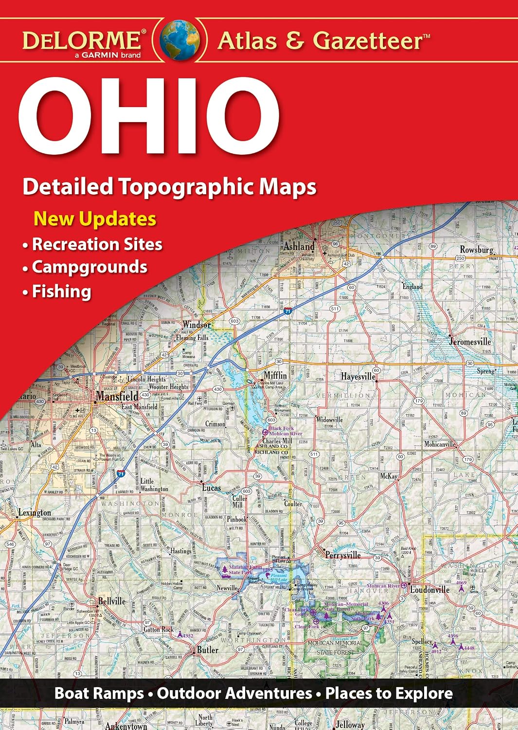
Discover the hidden gems of Ohio's great outdoors with the DeLorme Atlas & Gazetteer! Whether you're an avid hiker, an outdoor enthusiast, or simply looking to explore new places, this comprehensive book is your ultimate guide. With full-color topographic maps, you'll have access to detailed information on cities, towns, historic sites, scenic drives, trailheads, boat ramps, and even the best fishing spots. No more guessing or relying on outdated information – the Atlas & Gazetteer is your go-to resource.
One of the standout features of the DeLorme Atlas & Gazetteer is its extensive index. With this handy tool, you can easily find any location or point of interest within Ohio. Say goodbye to endless searching and hello to efficient navigation! Plus, the book's convenient dimensions of 15.5" x 11" make it the perfect travel companion, fitting easily into your backpack or vehicle.
Equipped with a latitude/longitude overlay grid for each map, the Atlas & Gazetteer allows you to navigate with precision using your GPS. Gone are the days of getting lost or wasting time trying to find your way – now, you can confidently explore Ohio's backcountry, knowing you have accurate guidance at your fingertips.
Don't miss out on the invaluable inset maps provided for major cities and all state lands. These detailed maps give you a closer look at specific areas, ensuring you don't miss any important landmarks or attractions during your adventures. From urban exploration to off-the-beaten-path journeys, the DeLorme Atlas & Gazetteer is the ultimate companion for any Ohio adventure.
Experience the thrill of discovering Ohio's hidden treasures and start planning your next excursion with the DeLorme Atlas & Gazetteer. With its wealth of detail, extensive index, and handy navigation features, this book is a must-have for every outdoor enthusiast. Get your copy today and embark on a journey you'll never forget! Click here to order now.
Discover More Best Sellers in Reference
Shop Reference
Road Atlas Ireland: Touring edition A4 Paperback (Collins Road Atlas)
 Reference - Road Atlas Ireland: Touring edition A4 Paperback (Collins Road Atlas)

Rand McNally Easy To Fold: South Carolina State Laminated Map
Reference - Rand McNally Easy To Fold: South Carolina State Laminated Map


Puerto Rico Map (National Geographic Adventure Map, 3107)
Reference - Puerto Rico Map (National Geographic Adventure Map, 3107)

Ecuador and Galapagos Islands Map (National Geographic Adventure Map, 3403)
Reference - Ecuador and Galapagos Islands Map (National Geographic Adventure Map, 3403)

Germany Map (National Geographic Adventure Map, 3312)
Reference - Germany Map (National Geographic Adventure Map, 3312)
![Reference - Utah National Parks [Map Pack Bundle] (National Geographic Trails Illustrated Map)](https://m.media-amazon.com/images/I/41KfP6bvVkL._SL500_.jpg._AC_SL1500_.jpg)