
Description
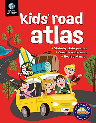
Book Synopsis: A great first atlas to introduce kids to the ways of the road! Each state features a simplified road map, state facts, and a fun state-related activity. This colorful, fun-filled book is perfect for capturing kids' interest and keeping them entertained the whole way.
- Real road maps of all 50 states, simplified for kids.
- Great travel games.
- State-by-state puzzles.
- State birds, flowers, trees, and capitals.
- Answer key is included in the back of the book.
Product Details: 80 pages; 8.5" x 11".
Details
Introducing the Rand McNally Kids’ Road Atlas Book, the perfect tool to introduce your little ones to the exciting world of road travel! This fun-filled atlas is packed with colorful maps of all 50 states, specially simplified for kids. With state facts, engaging travel games, puzzles, and even information on state birds, flowers, trees, and capitals, this book will keep your kids entertained and educated on those long road trips. Order your copy today and embark on a journey of discovery!
With its 80 pages and a convenient size of 8.5" x 11", the Rand McNally Kids’ Road Atlas Book is designed to be easily carried along on any adventure. Whether you're exploring a new state or simply driving through familiar territories, this atlas will provide endless entertainment. Say goodbye to the typical "are we there yet?" and keep your kids engaged with the fascinating information and interactive games inside.
Not only is the Rand McNally Kids’ Road Atlas Book a great source of entertainment, but it's also an educational tool for young minds. Each state is accompanied by fun facts and a fun state-related activity. It's a fantastic way to spark your child's curiosity about our wonderful country and encourage their desire to learn more. Plus, the answer key included in the back ensures that they can check their skills and knowledge.
Don't miss out on this fantastic opportunity to make your family road trips more enjoyable and educational. Order your copy of the Rand McNally Kids’ Road Atlas Book now and take advantage of its rich content, interactive features, and engaging design. Simply click here to get started on your journey towards unforgettable road adventures!
Discover More Best Sellers in Atlases & Maps
Shop Atlases & Maps
Road Atlas Ireland: Touring edition A4 Paperback (Collins Road Atlas)

 Atlases & Maps - Road Atlas Ireland: Touring edition A4 Paperback (Collins Road Atlas)

Rand McNally Folded Map: Phoenix Street Map
Atlases & Maps - Rand McNally Folded Map: Phoenix Street Map
 Atlases & Maps - National Geographic World Wall Map - Decorator - Laminated (46 x 30.5 in) (National Geographic Reference Map)
 Atlases & Maps - National Geographic: World Executive Enlarged Wall Map (73 x 48 inches) (National Geographic Reference Map)

Colorado Road & Recreation Atlas (Benchmark Recreation Atlases)
Atlases & Maps - Colorado Road & Recreation Atlas (Benchmark Recreation Atlases)


Argentina Map (National Geographic Adventure Map, 3400)
Atlases & Maps - Argentina Map (National Geographic Adventure Map, 3400)

Kentucky Map (National Geographic Guide Map)
Atlases & Maps - Kentucky Map (National Geographic Guide Map)
![Atlases & Maps - Yellowstone and Grand Teton National Parks [Map Pack Bundle] (National Geographic Trails Illustrated Map)](https://m.media-amazon.com/images/I/51a7g5v5y0L._SL500_.jpg._AC_SL1500_.jpg)
